Here’s the $12 solution to the onward flight dilemma.

Ever found yourself wildly underestimating travel times between destinations? On my first trip to Thailand, I planned to “quickly pop over” from Bangkok to Chiang Mai as though it were a casual crosstown jaunt. Reality check: it’s over 400 miles. And on my recent trip to South Africa, I had planned to land in Johannesburg midmorning, then make it to the Botswana border in time for early lunch…until I realized it was an almost 200 mile drive. This is why The True Size tool has become my first stop when planning any trip to unfamiliar territories.
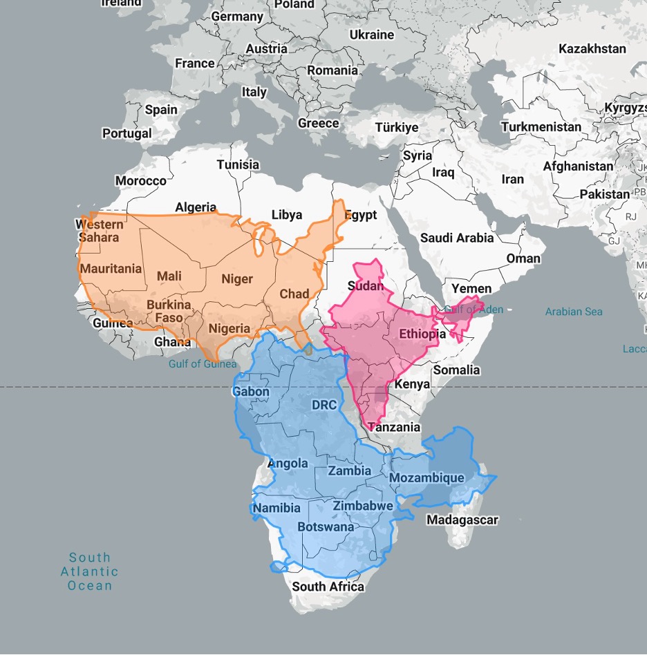
What makes The True Size so great is how it strips away the distortions we’ve all internalized from those misleading Mercator projections. (Refresher note: The Mercator projection, created in 1569, preserves angles and directions for navigation but severely distorts the size of landmasses the further they are from the equator. This distortion explains why Greenland appears similar in size to Africa on standard maps, when Africa is actually about 14 times larger.)
By dragging countries around the globe, you can see their actual proportions relative to places you know well. For example, Portugal isn’t just a tiny sliver; it’s about the size of Indiana. Understanding these true distances has saved me from the classic traveler’s folly of trying to cram five destinations into a three-day itinerary. Now when I plan, thanks to The True Size, I respect the miles, allocate proper travel days, and create itineraries that don’t leave me exhausted and rushing through experiences that deserve to be savored.
Twist’s Take: Use The True Size tool to visualize countries’ actual proportions without Mercator distortion to get a realistic sense of distances and help create manageable travel itineraries.
