How crowded will the train be? Are there checkpoints on the road? Get around more safely by public transport or car in the time of coronavirus with this popular app’s new features.
Google Maps now alerts users about restrictions, health checks, and other information related to Covid-19 that could impact travel plans.
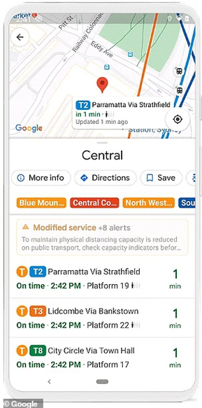
Taking public transport? The app will tell you if you need to wear a mask and whether schedules have been cut.

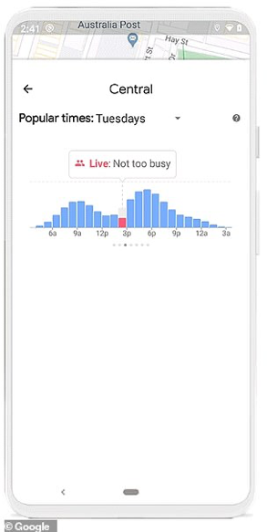
When it comes to crowdedness, as Google calls it, you can see historical trends of when stations tend to be busiest.

When available, you can also look at live data to see how busy a station currently is, compared to its usual level of activity.
The service is available in 13 countries—including the U.S., U.K., Mexico, Spain, France, and India—where information is available from local transit authorities. More are signing on every week.
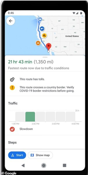
If you’re planning a trip by car across borders, an alert about Covid-19 checkpoints or eligibility requirements will appear both on the initial directions screen and later while in navigation mode along your route.

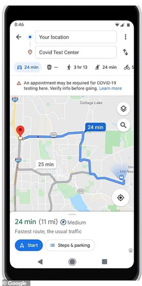
There’s also information on medical facilities and COVID-19 testing centers. For example, if a location doesn’t see patients without an appointment, that will be noted in the app.

Information is available for testing centers in the U.S. and medical facilities in the U.S., Indonesia, Israel, the Philippines, and South Korea, with more countries being added over time.
Twist’s Take: Traveling in the time of coronavirus? Check Google Maps for info on crowding on public transport, border restrictions, and testing facility requirements.
